
HERE IS THE MIDDLE LEVEL UPDATE by Kelvin Alexander-Duggan.
The pressures on the 190km of strategic waterways caused by the drought conditions and the additional requirements for water to help tackle the major fire incident at Holme Fen last week are unprecedented and severe. The system is very close to a critical tipping point in terms of the water levels within the Middle Level waters.
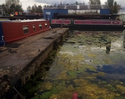 There has been no demonstrable abstraction from Middle Levels water for farming irrigation since 27th July 2026 but evaporation caused by the hot weather is having an impact. Water levels are well down on normal summer levels. On the section of the Old Nene through March, boats are dragging the bottom of the channel in places.
This is a rapidly evolving situation with no significant rainfall on the horizon to help recover water levels. A record high of 37.6C was recorded last week at Foxes Marina. Kelvin's image shows the depth of water in the marina.
What have the Middle Level Commissioners been doing?
The MLC have been involved in multi-agency meetings.
The Commissioners have been liaising closely with the Environment Agency regarding the water that may be available to the MLC to import into the Middle Levels from the Nene. This is an activity regulated by the Environment Agency.
The MLC have been operating their key structures that facilitate water transfer accordingly, namely Stanground Lock, Horsey Toll, Ashline Lock bypass and the gravity slacker at Bevill’s Leam Pumping Station. Locals may have noticed that Bevill’s Leam and the Twenty Foot River are flowing in the reverse direction to that which one would ordinarily expect.
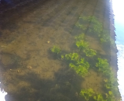 They are now equalising the water levels across the system and therefore boaters, anglers and other users will have started to notice a drop in water levels in what is known by the MLC as the St Germans pond. This includes the Old Nene, Twenty Foot River, Forty Foot River, Sixteen Foot River, Middle Level Main Drain, Pophams Eau and Ramsey High Lode.
The decision was taken last week week to close Lodes End Lock (and therefore the waterways in the West of Middle Levels) to navigation. It is expected that this will remain in place until there has been sufficient rainfall to enable recovery of the system. Kelvin's image shows the depth of water under March Bypass Bridge
Prognosis: on the future of the situation
Given their perched status from the main system, Well Creek and King’s Dyke (Stanground to Ashine Lock) are resilient to the current pressures and water levels should remain reasonably stable.
Boaters should adjust the slack in their mooring ropes to prepare for lower levels. The MLC have advised the two offline marinas to close their gates to conserve their water level Which has since been done.
Currently they do not see the need to formally close Ashline Lock, Marmont Priory Lock or Salters Lode Lock to passage or suspend navigation in the main system. Traffic via Stanground Lock has effectively stopped due to the Environment Agency’s close on the Lower Nene between Orton Lock and Dog-in-a Doublet.
Boaters are warned that if they choose to navigate on the main system, they do so at their own risk due to the low water levels. Vessels have different drafts, and some of our waterways are deeper than others.
As levels drop further and with the continued dry weather, It is anticipated the in-channel vegetation (weed) situation will worsen, and to avoid fish distress the MLC may need to suspend clearance activity. With lower levels the likelihood of fish distress increases as dissolved oxygen levels worsen.
The situation will remain under review with an update provided if there is a demonstrable change to this position.
Environmental incidents that may occur as level drop should be reported to the Environment Agency on their incident hotline 0800 807060.