New guide to Lancaster Canal
THE guide to the Lancaster Canal has now been updated with new text and illustrations and is now available.
‘The Complete Guide to the Lancaster Canal’ is a treasure trove of information, maps and photos which will appeal to boaters, especially those cruising the waterway for the first time via the Ribble Link.
 Journey South to North
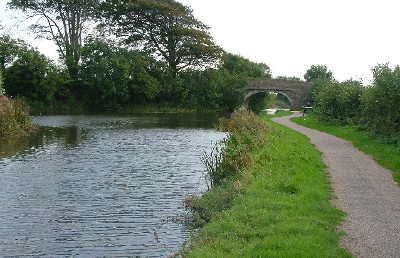
The 92 page guide opens with articles on the history, engineering and ecology of the canal. It then guides readers on each stage of a journey from South to North, starting with the Ribble Link in Preston (opened in 2002) and ending with an unnavigable section north of Tewitfield, near Carnforth, which was severed by the M6 in the 1960s.
Editor John Laws explained:
“This sixth edition is a much expanded and updated version of the previous guides. In 2019 the Lancaster Canal will be particularly in the spotlight as everyone celebrates its 200th anniversary. We are expecting boaters and tourists from all over the country to join with us in marking the incredible achievement of its completion from Preston to Kendal.
“Much has happened since the last version of the guide five years ago. The towpath from Canal Head in Kendal to Natland is due to be developed as a towpath walking trail. The canal has been crossed by the new ‘Bay Gateway’ link road at Milestone Bridge, near Lancaster, and the guide also features a new section on coke ovens, similar to lime kilns, that once proliferated along the canal in its working heyday.”
At every stage of the canal journey the guide offers readers essential instructions, top tips and facts, including up-to-date information on nearby places of interest, shops, services, restaurants and pubs.
‘The Complete Guide to the Lancaster Canal’ is priced £6.50 and is published by the Lancaster Canal Trust. The guide is available from local bookshops and tourist information centres or through the Lancaster Canal Trust website.